TRAVEL STORIES & GUIDES
8 Scenic Drives Northern Ireland: Routes Worth the Miles
A car gets collected at Belfast City Airport before nine, and there's one clear morning and a free afternoon to spend. The question isn't whether to drive. It's which direction to point the bonnet. North to the Causeway Coast, up into the Glens of Antrim, or south to the Mournes, and the answer shifts with the weather, the driver's appetite for single-track lanes, and whether the day is built around cliff walks, forest waterfalls or a garden and a plate of seafood.
Northern Ireland is compact, which is both the pleasure and the trap. The Department for Infrastructure looks after more than 26,000 kilometres of public roads, alongside roughly 9,700 kilometres of footways and 5,800 bridges (Northern Ireland government consultation portal), and that network squeezes cliffs, mountains, lakes and coastline into distances that look short on a map. They often are short. They're rarely quick.
So the eight scenic drives in Northern Ireland below aren't ranked. Each is filed by the kind of day it suits, from a full coastal marathon to a two-hour loop with nothing open for miles, so the route matches the time, the confidence and the company rather than a league table.
1. Causeway Coastal Route for the Full Coastal Day
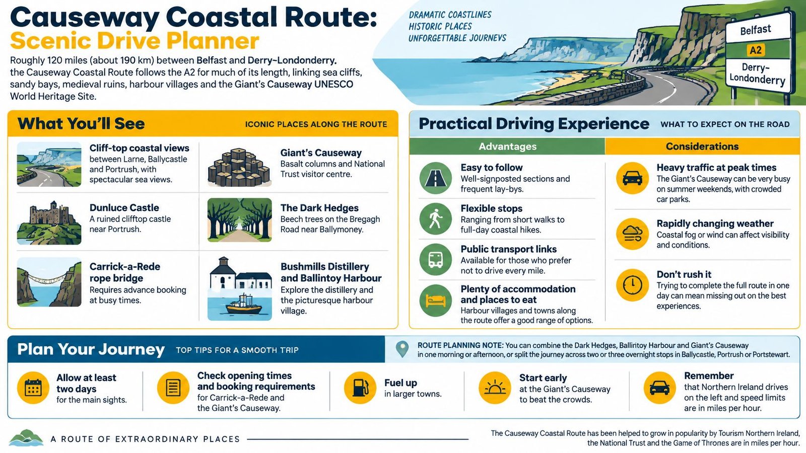
The Causeway Coastal Route is Northern Ireland's defining coastal drive, linking Belfast with Derry~Londonderry, much of it along the A2. Cliffs, sandy bays, harbour villages and open headlands keep the scenery changing, with views across the North Channel and, on a clear day, towards the Mull of Kintyre.
The Giant's Causeway, a UNESCO World Heritage Site, is the route's best-known stop and a popular visitor attraction. Treat it as the day's main commitment: crowds and parking can slow the schedule, so leave room between stops rather than trying to fit every viewpoint into a tight timetable.
A sample day from Ballycastle to Portrush
Set out from Ballycastle in the morning and walk at Carrick-a-Rede before continuing to Ballintoy harbour. Allow time at the Giant's Causeway for the stones and visitor centre, then head west to Dunluce Castle and Whiterocks beach before an early dinner in Portstewart. This is a full day with several stops, not a quick coastal detour. For a slower visit, split the route across two or three nights.
- Book timed sites first. Carrick-a-Rede and the Giant's Causeway visitor experience use timed slots, and opening hours vary through the year. Check arrangements before setting off.
- Refuel in towns. Services are less frequent on quieter stretches. Starting with enough fuel avoids adding an unnecessary search for a petrol station to a busy day.
- Know the motorway rules for the journey from Belfast. The motorway speed limit is 70 mph unless a lower limit applies. A red X marks a closed lane, and if you miss an exit, continue to the next one rather than reversing (nidirect motorway rules).
- Drive on the left. Speed limits are shown in miles per hour. On the A2, a steady pace leaves more time to enjoy the coast and respond to traffic.
For a stop-by-stop itinerary with overnight bases already selected, use this five-day Causeway Coastal Route plan for US travellers.
2. Torr Head Scenic Route, the Half-Day Loop With Teeth
Torr Head is the antidote to all that company, and the strongest argument for reading the road rather than the itinerary. The route runs between Cushendun and Ballycastle on the north-east tip of County Antrim, climbing to a viewpoint that looks across the North Channel to Rathlin Island and, if the cloud lifts, to the Mull of Kintyre in Scotland.
The surface is the issue. Tight bends, steep sections and single-track stretches with passing places demand a different kind of attention from the A2, and the region's crash record shows why rural lanes deserve respect. Official road-safety figures record that 43 people were killed on rural roads in 2025, out of 56 road-traffic fatalities overall, about 77% of all deaths (Northern Ireland Road Safety Strategy annual statistical report 2025).
The passing-place rule: if a local in a van fills your mirror, pull in at the next passing place and wave them through. Ten seconds costs nothing, and the rest of the climb is far more enjoyable.
A sample half-day, Cushendall to Murlough Bay
Leave Cushendall mid-afternoon, drive the coast road north as the light falls across the water, and stop at the headland for the Scottish coast. Drop to Murlough Bay for a short walk if the weather holds, then finish in Cushendun with a wander round the village and something warm.
Two things matter more than the schedule. Carry offline maps, because signal is unreliable on the headland and a wrong turn on a single-track road takes longer to fix than it should. And check the wind and low cloud, since either can delete the view you came for. This is a fair-weather route with a big payoff, not a wet-day filler.
Quieter stretches like this sit at the heart of a coastal route built around Ireland's hidden corners.
3. Glens of Antrim Scenic Drive for a Woodland Half-Day
Nine river valleys run from the Antrim plateau down to the sea between Ballycastle and Larne, and the roads through them feel different from the coast road immediately. Wooded gorges, waterfalls and a shoreline of the Irish Sea replace exposure with shelter, which makes the Glens the sensible choice when the wind is up on the headlands.
Glenariff does the heavy lifting. Often called the Queen of the Glens, it holds Glenariff Forest Park and its Waterfall Walkway, a path that trades cliff-top drama for riverside boardwalks, red squirrels and the sound of falling water. The driving is the gentlest in this list too. Short hops between villages, plenty of places to turn round, and no need to commit to a long stretch of road.
Expect company at the car parks rather than the wheel. Tourism Northern Ireland's Visitor Attitude Survey, based on 2,950 respondents, rated road quality at 7.15/10 and the availability and cost of parking at 7.08/10, which reads as broadly good with real friction at peak times (Visitor Attitude Survey 2018 fact card).
A sample woodland day
Start at Glenariff Forest Park in the morning while the trails are quiet, walk the waterfall circuit at whatever length suits, then drop to Cushendall for lunch and finish on the coast at Cushendun. Half a day is enough. A full day is better if the walking matters more than the driving.
Wear boots you'd wear in a bog, because forest trails stay wet well into summer. Check parking charges and opening arrangements before setting off, especially outside the main season, and use Cushendall or Waterfoot as a base if you want lunch without a detour.
4. Mourne Mountains Scenic Drive When the Weather Writes the Plan
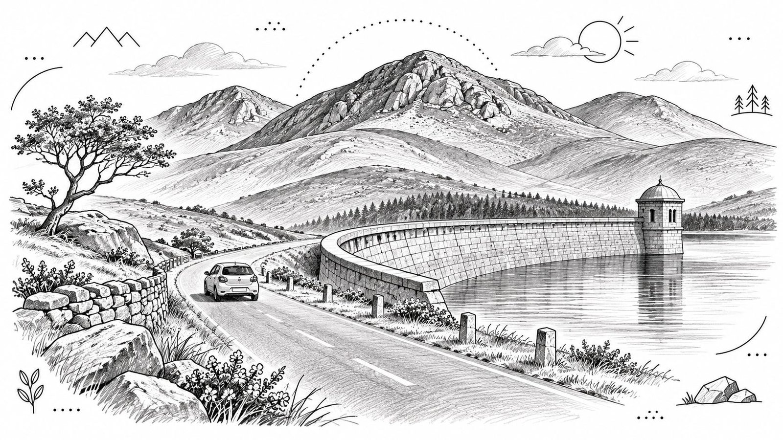
The Mournes don't ease you in. South of Newcastle the granite rises straight out of the coast, and the drive along the edge of the range towards Kilkeel serves mountain scenery without a long hike. Slieve Donard presides, Dundrum Bay opens behind you, and the detour inland to the Silent Valley reservoir, held by its long granite wall, is the part that stays with you.
A sample day with weather insurance
Take the Silent Valley early, walk part of the reservoir path, and come back to the coast for lunch in Kilkeel or Newcastle. Add Tollymore Forest Park in the afternoon if the legs are still willing. If cloud is sitting on the tops, skip the hills and drive the coast road instead, because the views across Dundrum Bay don't need a summit.
Check the road before you commit to the valley. The Department for Infrastructure normally needs at least three weeks' notice to close a public road for routine works, because a legal and consultation process applies, while emergency closures go in immediately where there's an immediate danger such as subsidence (nidirect road closures and diversions). On a route that depends on one road in and out, that check is worth two minutes.
- Arrive early for Silent Valley and Tollymore. Parking goes on fine weekends well before midday.
- Carry warm layers in any month. The tops run several degrees colder than the coast.
- Take food and water. Facilities in the hills are thin, and the nearest shop is a drive away.
5. Strangford Lough and Ards Peninsula Drive for a Ferry-and-Gardens Day
Strangford Lough is one of the largest sea inlets in the British Isles, and the loop around the Ards Peninsula is the most underrated good day out in County Down. The car ferry between Strangford and Portaferry takes minutes and turns a there-and-back drive into a proper circuit, which is the whole trick of the route.
The character is gentle. Mount Stewart and Castle Ward sit on the lough shore, Portaferry has Exploris for marine life and children, and the villages along the peninsula do seafood well. This is a day for gardens, birdlife and a long lunch rather than cliffs and adrenaline, and it suits anyone travelling with passengers who don't enjoy exposed coastal roads.
Northern Ireland recorded an estimated 5.1 million overnight trips, 15.0 million overnight stays and £1.2 billion in associated expenditure in 2025, each up 9% on 2024 (Department for the Economy tourism statistics). Villages like Kircubbin and Portavogie are where some of that spending can land, provided visitors stay a night rather than pass through in an afternoon.
A ferry timetable is not a detail. Miss the last crossing with a dinner booking in Portaferry and the drive round the top of the lough adds an hour of evening you hadn't planned.
A common route starts at Newtownards, takes in Mount Stewart and Castle Ward, then crosses to Portaferry by ferry with a seafood lunch in Portavogie or Kircubbin on the way. Allow half a day for the main sights, or a full day with a walk and lunch, and book estate visits in advance during busy periods.
6. Sperrin Mountains Scenic Drive for a Rural Day With Few Services
The Sperrins are the least crowded uplands in Northern Ireland, and this is the drive that most rewards a full tank and a paper map. The route links river valleys, forest tracks and open moorland across County Tyrone and County Londonderry, with the Glenelly Valley and Gortin Glens as the set pieces. Views run over farmland to distant peaks and, for long stretches, there's nothing else on the road.
Services are the trade-off. Fuel up in Omagh or Plumbridge before you climb, carry water and snacks, and don't count on a café appearing at the moment you want one. Signposting in rural areas is sometimes limited, which is where the map earns its place.
A sample rural day
Start in Omagh or Plumbridge, follow the Glenelly Valley north with a stop for the view, then loop back through Gortin and walk one of the forest trails in Gortin Glens. Derry~Londonderry makes a sensible base if you want a city evening after a day of empty road. Give it at least a day, and check the forecast before heading onto higher ground.
The border is close here, which changes a few things. There are no road tolls in Northern Ireland, but speed limits are posted in miles per hour north of the border and in kilometres per hour south of it. Visitors drive on the left, need a valid licence and proof of insurance, must stay under a blood-alcohol limit of 80 milligrammes per 100 millilitres of blood, and can't use a hand-held phone at the wheel (nidirect guidance for visitors driving in Northern Ireland).
Treat the posted limit as a ceiling rather than a target. Narrow lanes, sheep and tractors set the pace out here, and a schedule built on open-road speeds will fall apart by lunchtime.
7. Lough Erne Lakelands Drive for a Slow Day on the Water
Lough Erne is two lakes strung along the River Erne with Enniskillen sitting between the upper and lower, and the roads around it make the gentlest full day in this list. Wooded shores, small towns, jetties and a horizon full of islands replace the drama of the coast with something slower. For drivers who want scenery without a single demanding bend, Fermanagh is the answer.
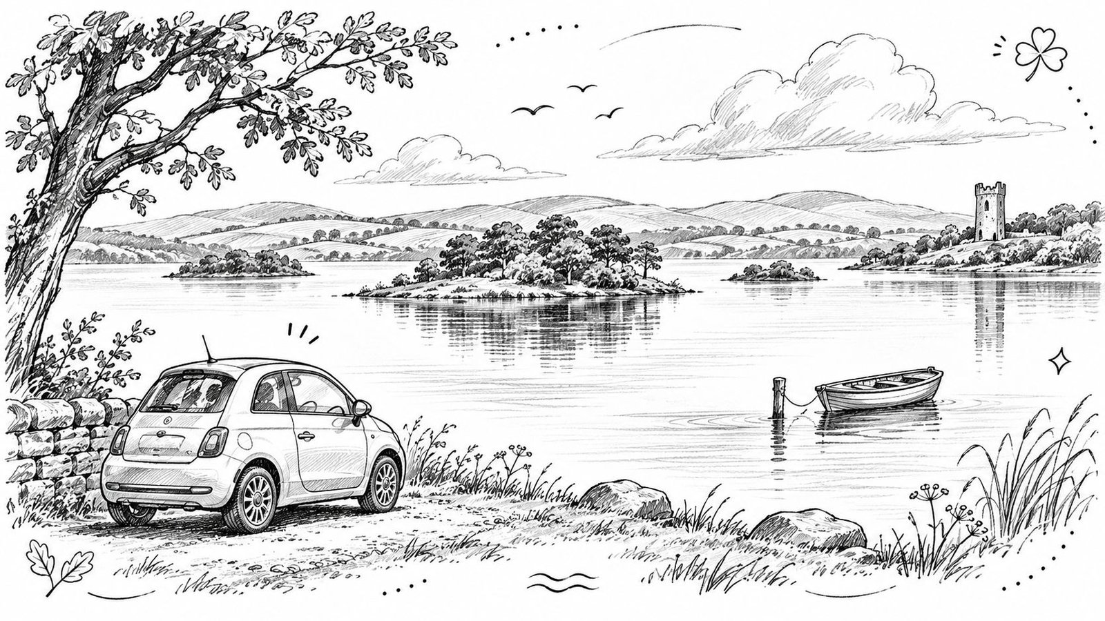
The set pieces sit close together. Castle Coole, the National Trust neoclassical house on the edge of Enniskillen, opens in the morning, Devenish Island is reached by boat, and Belleek at the northern end is known for its pottery. Marble Arch Caves adds a half-day underground if the weather turns, and there's no shame in parking the car for an hour to let a boat do the work.
The demand supports a slower route. NISRA recorded an estimated 4.692 million overnight trips in Northern Ireland in 2024, associated with £1.1 billion in visitor expenditure (NISRA tourism statistics 2024), and Fermanagh is where some of those nights can be spent well away from the coach circuit.
A sample slow day
Castle Coole in the morning, lunch in Enniskillen, a boat trip to Devenish Island in the afternoon, and a drive up the western shore towards Belleek if there's light left. Nothing on that list needs an early alarm. Check boat timetables before setting out, book Marble Arch Caves tours ahead in summer, and use Enniskillen as a single base for both lakes rather than moving hotels.
8. Ring of Gullion Scenic Route for a Short Quiet Loop
The Ring of Gullion is a ring of hills around Slieve Gullion, the highest mountain in County Armagh, and the route through it is short enough to fit into a morning and odd enough to remember. The loop runs through small villages, forest tracks and farmland, with the Cooley Mountains and the Mourne foothills on the skyline and a strong sense of land worked for centuries.
Slieve Gullion Forest Park is the anchor, with walking trails and access towards the summit area. From Newry the route climbs to the forest park, continues through Forkill and returns, which makes it the easiest of these drives to slot into a border-crossing itinerary or a short break based in Belfast.
Temporary works can eat into a tight loop. Where a Road Works Ahead sign appears, follow the additional signs, obey any temporary maximum speed limit and don't switch lanes to overtake queuing traffic. Where a lane is restricted, merge in turn, keep out of areas marked by cones, and expect mud or grit on the surface (nidirect on road works and level crossings).
Two to four hours is the honest estimate for the loop, plus whatever the walk to the summit takes. It's not a route to rush before a ferry.
Carry water and snacks, because facilities are limited, and check the weather before the summit walk, which is more exposed and steeper than the drive suggests. It pairs well with other quiet routes in this collection of hidden scenic drives in Ireland and Wales.
How the eight Northern Ireland scenic drives compare for planning
| Item | Suggested time on the road | Best for | Driving character | Main consideration |
|---|---|---|---|---|
| Causeway Coastal Route | At least two days | Frequent stops at coastal sights and villages | Well-signposted coastal route with frequent lay-bys | Summer traffic and changeable coastal weather |
| Torr Head Scenic Route | A short drive; suits a half-day outing | Quiet coastal scenery and a sense of isolation | Narrow, steep and winding, with single-track sections | Passing places require careful driving; not suitable for large vehicles or caravans |
| Glens of Antrim Scenic Drive | At least half a day | Short walks, waterfalls and forest scenery | Winding roads through valleys and along the coast | Some roads are narrow, and trails can be muddy after rain |
| Mourne Mountains Scenic Drive | A full day if walking | Mountain scenery, coastal views and walking options | Relatively short drive with some narrow, steep upland roads | Mountain weather changes quickly; popular parking areas fill early |
| Strangford Lough and Ards Peninsula Drive | Half a day for main sights; a full day with a walk and lunch | Gentle scenery, wildlife, gardens and seafood | Easy driving on mostly good roads, with a short car ferry crossing | Check ferry times and fares, and seasonal attraction opening hours |
| Sperrin Mountains Scenic Drive | At least a day | A quiet rural experience, hiking and photography | Open rural roads with long stretches between villages | Food, fuel and other services are limited |
| Lough Erne Lakelands Drive | A full day | Water views, historic houses, boat trips and a relaxed pace | Gentle driving on mostly quiet roads | Boat trips and cave tours may need advance planning |
| Ring of Gullion Scenic Route | Two to four hours, plus time for walks | A short, quiet loop with landscape and historical interest | Easy-to-follow loop with some narrow, exposed upland sections | Facilities are limited and signposting can be sparse |
Matching the Drive to the Days You Have
Eight routes, and the choice comes down to time rather than taste. With one clear day, take the Glens of Antrim for woodland and waterfalls, the Ring of Gullion for a short quiet loop, or the Strangford and Ards circuit if gardens and a ferry crossing appeal. All three fit between breakfast and an evening meal, with room for a walk and a proper lunch.
Two days or more changes the calculation. The full Causeway Coastal Route deserves at least two nights, ideally three if Carrick-a-Rede, the Glens and the Torr Head detour all matter. The Sperrins and the Mournes work better with a base than as pass-through drives, and Lough Erne is best treated as a day with a boat in the middle rather than a route to tick off.
Three habits save a trip whatever the plan. Check opening times, ferry timetables and booking requirements for Carrick-a-Rede, the Giant's Causeway visitor experience and any National Trust property before setting out. Fill the tank before rural stretches. Build slack into every day for weather, road works and the stop that turns out better than the one on the list.
Cross-border traffic is worth factoring in. Visits from the Republic of Ireland rose 15% in 2025, from 1.1 million to 1.3 million, with expenditure up 31% to approximately £317.1 million (Department for the Economy tourism announcement). Routes near the border, particularly the Sperrins and the Ring of Gullion, are busier in season than their quiet reputations suggest. Packing for the weather you'll get matters just as much, and a road-trip packing list built on layers and waterproofs will do more for a Northern Ireland drive than any itinerary app.
If the appeal is the route without the admin, BTOURS runs self-drive trips across Ireland with the arrangement already done: an arranged route with planned overnight stops, and the traveller controlling the daily pace between them. Vehicle hire may be included, optional or not included depending on the tour, so check the individual tour page and confirm live prices and availability in the booking flow. Browse the BTOURS self-drive collection to see current journeys, or use the BTOURS Travel Hub for third-party car hire and accommodation if you'd rather build your own version. Start with the day you have, pick the drive that fits it, and book the first night before the rest.
Links disclosure: This article may contain external links, including affiliate links. If you book or buy through an affiliate link, BTOURS may earn a commission.