TRAVEL STORIES & GUIDES
Getting Around Wales Without a Car: Rail, Bus and Bases

Most car-free Wales guides suggest basing yourself at three or four towns on the rail map and day-tripping from each. It reads well and it often collapses in practice, because a station on the map tells you nothing about whether you can walk out of it with a suitcase, find a pavement and reach a bed before the light goes.
A rail-served village is not necessarily an easy one. Many Welsh stations sit on narrow roads without pavements, taxi ranks or staff, and the last bus onward may run two or three times a day and not at all on Sundays. The full door-to-door journey is the planning unit that matters: the train, the wait at the interchange, the bus onward, the walk at the end of it.
That reframing changes the shape of a trip. Fewer bases, longer stays, one corridor a day, and a hard rule that every final connection gets checked and backed up. Wales rewards that discipline. It is a small country with a real rail spine and a bus network that reaches the places the railway misses, and the travellers who enjoy it most are usually the ones who stop trying to cover ground.
Table of Contents
- How Public Transport Covers Wales
- Choosing Bases Along the Rail Corridors
- How Rail, Buses and Combined Tickets Connect
- Last-Mile Access, Stations and Luggage
- Timetables, Reliability and Budget
- Car-Free Itinerary Ideas for Three to Seven Days
- Booking Your Car-Free Wales Trip Next
How Public Transport Covers Wales
A car-free trip around Wales works, and it works best when the plan starts with the rail corridors and treats the last few miles as the slow part rather than an afterthought. The country is car-dependent, which is exactly why its public transport exists in usable form: the Welsh Government's Census 2021 travel analysis recorded 772,600 employed residents, 56.5% of the employed population, who normally drove a car or van to work, against a driver share of 44.5% in England. A further 4.8% travelled to work as car passengers.
Demand on the alternatives is established, not marginal. Transport for Wales reported 34.9 million rail passenger journeys in 2025/26, a 9.9% increase year on year, with TrawsCymru bus journeys also up 5.2%, while cars and taxis still accounted for 77.7% of motor-vehicle traffic in 2025. Rail and scheduled buses are real networks with real pressure on them at peak times.

The five modes ranked by dependability
- Transport for Wales trains, the backbone. The North Wales Coast line links Bangor and Llandudno, the Cambrian runs down the west side through Aberystwyth and Barmouth, and the South Wales lines thread through Cardiff and Swansea. Build the trip on these.
- TrawsCymru buses, the inland reach. These routes serve towns and mountain gateways the railway never reached, and they connect with trains at named points rather than vaguely near them.
- Local buses, the last mile. Useful and often charming, but some run only a few times a day, so they set the shape of the day rather than fitting around it.
- Walking and rail-to-trail routes. Plenty of good walks begin at a station or a bus stop, which removes the awkward gap between arriving and starting.
- Taxis, the safety valve. Rural availability varies and advance booking helps. Treat a taxi as the backup for one specific leg, not as the plan.
| Mode | Best use | Watch for |
|---|---|---|
| Transport for Wales trains | Main corridors linking coastal and inland towns | Fewer services on rural branch lines and in the evenings |
| TrawsCymru bus routes | Inland towns and mountain gateways beyond rail | Route-specific timetables; connection points matter |
| Local bus | Villages and last-mile links | Infrequent, sometimes only a few runs a day |
| Walking and rail-to-trail routes | Scenic walks starting at stations or bus stops | Distance, climbs and surfaces vary |
| Taxis | Final leg when no bus fits | Availability varies in rural areas; book ahead where possible |
The planning rule that saves the most trips: map the rail corridor first, add buses only for the places it misses, and never build a day around a single infrequent bus without a backup for the return.
Choosing Bases Along the Rail Corridors
A station-walkable town almost always beats a remote cottage, even when the cottage sits closer to the thing you came to see. Judge each option by the full door-to-door journey, last mile included, and the cottage's advantage usually evaporates: an hour saved at midday, then nothing between the last evening bus and the first morning one. That gap is where car-free itineraries break.
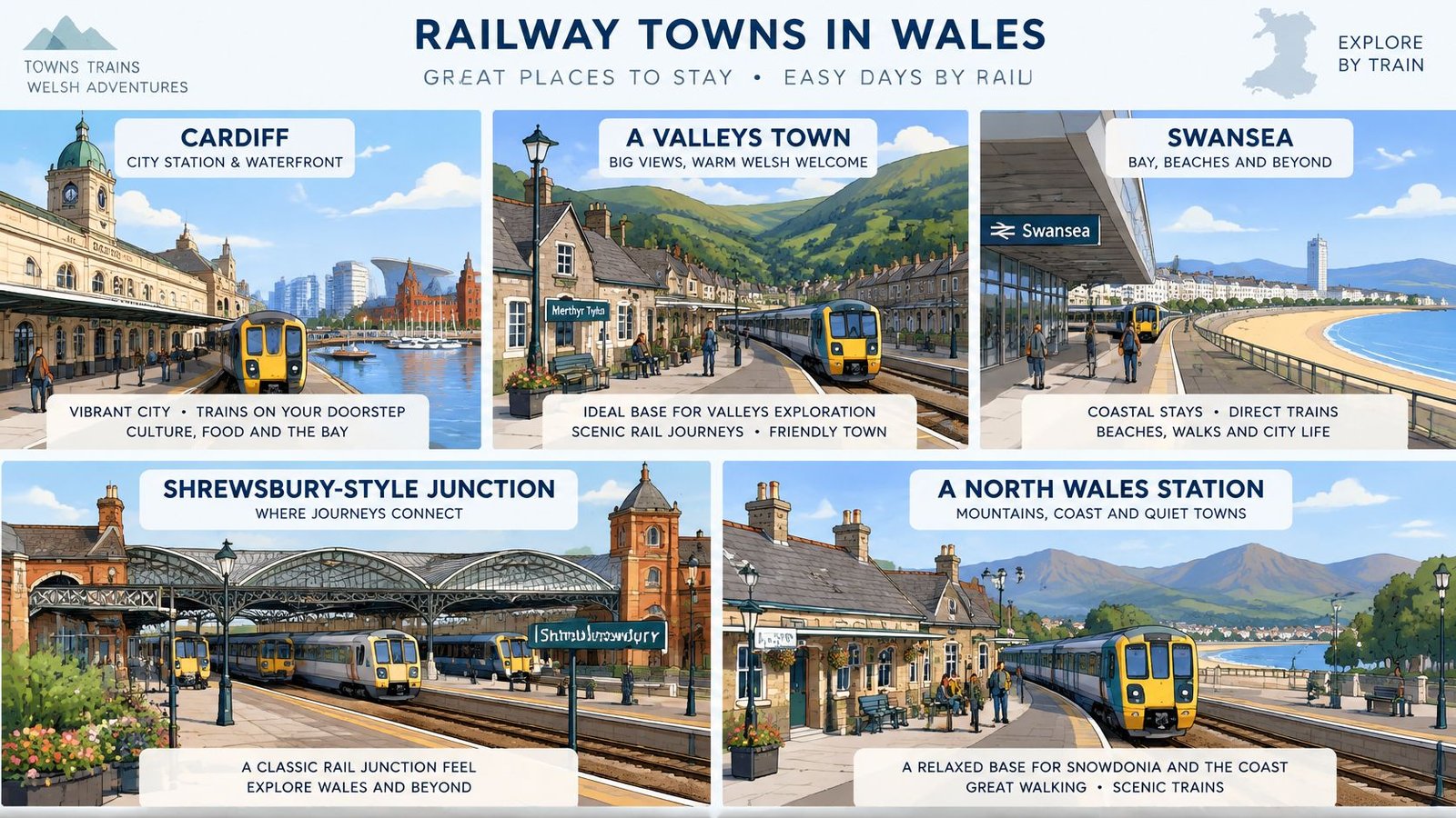
Five bases cover the country's distinct regions without forcing long, fragile transfers between them. Fewer bases with longer stays work better than a base-hopping circuit, because every move costs half a day to platforms and luggage.
| Base | Region | Rail or bus link | Day trips | Why it works |
|---|---|---|---|---|
| Cardiff | South Wales | Major rail hub | Barry Island coastal walk; Brecon by combined rail and bus ticket | Most rail links, so day trips take little planning |
| Swansea | South West Wales | Main line rail | Gower coast by local bus where timetables allow | Good gateway to the west coast |
| Aberystwyth | Mid Wales | Cambrian line rail; TrawsCymru T1 and T2 | Pen Dinas hillfort; Lampeter and Aberaeron by T1 | Rail and bus routes meet in one town |
| Bangor | North Wales | North Wales Coast line; TrawsCymru T2 | Caernarfon by T2; Snowdonia by bus | Strong base for northern routes |
| Barmouth | Mid Wales coast | Cambrian line rail | Barmouth Bridge and Mawddach estuary walk | Walks start from the station |
Cardiff is the least demanding choice, because almost every day trip starts with a train rather than a connection. Swansea works as a gateway: the further west along Gower you aim, the thinner the bus service gets, so a Gower day needs checking rather than assuming. Aberystwyth is the standout for a car-free traveller, since rail and long-distance bus routes meet in the same small town. Bangor does the same job for the north, and Barmouth puts a serious estuary walk within a few minutes of the platform.
Reliability decides the base
Service performance is uneven, which is the argument for sleeping near the platform. Census figures show that a sizeable share of people in Wales have no access to a car or van, so buses and trains carry residents doing ordinary things, not just visitors. Transport for Wales performance data shows Core Valley Lines services at roughly 93% on time to three minutes, while Wales and cross-border services sat around 75%, with variation by reporting period.
Read that as a reason to choose the base well, then plan days around it. How much buffer a rural connection needs, and how to handle the last return of the evening, is covered in the timetables and reliability section below. The decision that matters here is picking a base where you need those tight connections rarely, if at all.
- Shortlist two bases first. Compare them on the same three tests: walking distance to the station, frequency of evening services, and how many day trips need only one leg.
- Check the actual address against the platform. A property described as "near the station" can still be a 25-minute walk on an unlit lane.
- Stay longer in fewer places. Two bases for a week beat four or five short stops, because every change of town spends time on platforms with luggage in hand.
If the wider map is still open, this guide to the places to visit in Wales helps narrow the shortlist before committing to a base.
How Rail, Buses and Combined Tickets Connect
On the TrawsCymru network, the connection point decides whether a journey works at all. Three routes link directly with rail, and matching each route to its interchange takes the guesswork out of planning.
The T1 meets trains at Carmarthen for journeys onward to Aberystwyth, Lampeter and Aberaeron. The T2 connects at Bangor or Aberystwyth for Caernarfon, Penygroes, Trawsfynydd, Dolgellau and Machynlleth. The T6 connects at Neath for Ystradgynlais and Brecon. Each pairing is a specific promise: a train arrives, a bus leaves from the same place, and the journey continues.
Some of these rail-to-bus journeys are sold as single through fares:
| Journey | Published example fare |
|---|---|
| Swansea to Aberystwyth | £16.40 (Anytime Single) |
| Holyhead to Machynlleth | £15.60 |
| Cardiff to Brecon | £18.60 |
The fares above are published examples from Transport for Wales's TrawsCymru page; confirm the price in the live booking flow for the dates travelled. These are combined rail-and-bus tickets for selected routes, sold as one fare rather than two separate purchases. One ticket, one transaction, and no second fare to find at a rural bus stop. They can be bought online, through the TfW app or at railway stations, which matters when the bus stop itself is nothing more than a pole.
How to use a combined ticket well
Check that the ticket covers the exact route and direction intended, because a fare attached to a named corridor only applies on that corridor. Then judge the connection by the whole journey rather than the timetable's minimum. A bus leaving four minutes after the train arrives is a connection only if the train is on time; where a later bus exists, take it and treat the wait at the interchange as part of the plan. Keep the ticket accessible on a phone, since a rural driver may need to see it in poor light.
Groups add a wrinkle of their own: one person usually ends up holding every ticket and every timing, and anyone managing that job for a larger party will recognise the logistics covered in these group travel tips for southern Ireland, where the same pattern of one organiser, one document and a shared timetable applies.
When a heritage line fits the day better than a scheduled service, the guide to heritage railways in Wales shows where the steam and narrow-gauge routes sit in relation to the main network.
Last-Mile Access, Stations and Luggage
A rail-served destination is not the same thing as an accessible one. Transport for Wales station accessibility information makes the point sharply with Abererch, which sits on a narrow rural road with no pavement, has no ticket office, toilet, seating, staffed information point or accessible set-down area, and requires a conductor-operated ramp for boarding. The train stops. That's the whole of the promise.
This matters beyond wheelchair users. It matters to anyone with a suitcase, a buggy, a knee that dislikes steps, or an arrival time after dark. It also matters to the residents who depend on these services most: the National Survey for Wales for the year ending March 2023 found 88% of people had access to a car, leaving 12% without normal household access, and that figure fell to 64% among people in social housing and 67% among single pensioners. An unusable station isn't an inconvenience for a niche group. It's a barrier to the shops.
A checklist for judging any stop
Apply the same eight questions to every final stop on the itinerary, and drop or reroute anything that fails two or more.
- Is there a safe walking route from the platform, with pavement or a verge, rather than a fast road with no shoulder?
- Is access step-free, and does boarding need a ramp that only the conductor can place?
- Is there seating and shelter if the connection runs late in wind and rain?
- Are there toilets at the station or within a short walk?
- Is anyone on duty, and is there a working information point or help point?
- Can a taxi be booked, and can it be booked before arrival rather than on the platform?
- How far is the accommodation, measured on foot with luggage rather than as the crow flies?
- How exposed is the walk to weather, traffic and darkness at the hour you'll arrive?
Conditions change, and the Welsh Government has said it will audit train-station accessibility from spring 2026 and review bus stops, stations and interchanges by spring 2030, so check the current position close to travel rather than relying on an old description.
On luggage, the honest position is that this style of travel means carrying your own bag between stations, platforms, hotels and vehicles unless porterage is expressly included in what's been booked. That makes bag choice a practical decision, not a fashion one: a light pack or a wheeled case with stable wheels for rural surfaces. Anyone considering a small personal vehicle for the station-to-accommodation hop should read these reviews of balancing scooters for commuters before assuming one suits a village with no pavement.
Check every final stop on a map at street level, then confirm the onward link exists on the day you need it. If either check fails, move the base.
Timetables, Reliability and Budget
A line on a national rail and bus map proves that a route exists. Reliability is a separate question: how often the service runs, whether it runs on the exact day you need, and what happens when weather, engineering work or a missed connection cuts the margin. A scenic bus can look close enough on the map and still leave a two-hour gap after lunch, a Sunday-only timetable, or no practical return when the attraction shuts.
Welsh Government transport statistics are published as separate datasets for bus passenger journeys and vehicle kilometres through the 2024 to 2025 financial year, with local bus fare changes tracked in a distinct dataset through 2025. Read alongside each other, they describe a network that is measured carefully and priced locally, so a fare quoted for one valley tells you little about the next.
The pre-departure routine
- Check the live timetable the day before, then again on the morning of travel.
- Use printed timetables for sparse local routes. Transport for Wales publishes them for infrequent services, and a screenshot stays frozen while the service changes.
- Confirm which timetable version applies to your dates, especially around seasonal changeovers and school holidays.
- Check for engineering works in the week before travel, while there is still time to move a rail day.
- Limit each day to one principal corridor, keep changes few, and treat the last local bus as a hard constraint with a booked taxi behind it.
- Put the buffer night beside the risky departure, in a well-connected base before a ferry, flight or fixed tour rather than after a same-day dash.
Every one of those checks depends on a live connection, and mobile signal along rural Welsh lines is patchy. A UK data plan kept ready before landing, such as these RedSim plans for British business trips, keeps the operator timetable and disruption alerts reachable when station wifi fades.
The earlier base choice pays off here. The dependable pattern set out in the first section, fewer bases with longer stays, is what makes a missed 10:42 an inconvenience rather than the event that breaks the week. Judge each day door to door: platform to platform, then the walk, taxi or bus that closes the last mile.
Budget line to remember: the fare between major towns is rarely the expensive part. Local buses, taxis, occasional transfers and a spare night are what move the total.
Build the estimate from those items and treat any quoted example fare as a reference point rather than a costing. Family fare rules and off-peak concessions can change the maths, so check the current Transport for Wales terms before pricing four seats as adults. Then total the day as it will really be travelled: train, onward link, last-mile walk, backup if the final bus fails, and the cost of sleeping near the next morning's departure.
Car-Free Itinerary Ideas for Three to Seven Days
Wales has a workable rail-to-walk network, so a walking holiday doesn't need a car at the trailhead. Three trips built on the bases above cover short breaks and a full week without a single taxi dependency, and each is designed so that the day ends near a platform.
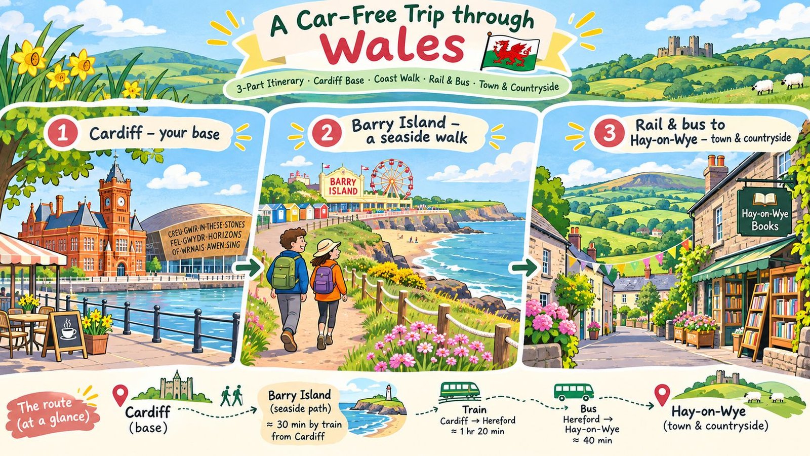
Three days, one base in Cardiff
Two nights in Cardiff, with the Barry Island walk as the centrepiece. Transport for Wales lists the route as 2.4 miles, roughly 1.5 hours, following Nells Point, Whitmore Bay and Friars Point, and describes it as suitable for wheelchairs, scooters and buggies, though there's a steady climb at the start. That climb is the detail worth knowing: it comes early, so it sets the tone rather than spoiling the finish.
Five days along the Cambrian line
Two nights in Aberystwyth, then two in Barmouth, both on the same rail corridor so the transfer is a train ride rather than an expedition. From Aberystwyth, the listed walk covers 4.7 miles in around 2.5 hours, combining the south beach and riverside with an optional extension to Pen Dinas hillfort. From Barmouth, 4.3 miles and roughly 2.5 hours crosses Barmouth Bridge and circles the Mawddach estuary towards Fairbourne railway, and a small ferry completes the return crossing between Easter and October. Outside those months, plan the return on foot.
Seven days across three bases
Cardiff, Aberystwyth and Bangor, two nights each, is the version that shows how varied the country is without becoming a relay race. The payoff day is Caernarfon by TrawsCymru T2 from Bangor, which puts a castle and a walled town on a bus route. Build in a full day for the cross-country changes and check each leg before booking.
| Trip length | Suggested bases | Main travel | Day trips |
|---|---|---|---|
| 3 days | Cardiff (2 nights) | Local rail and walking | Barry Island coastal walk |
| 5 days | Aberystwyth (2 nights), Barmouth (2 nights) | Cambrian line rail | Aberystwyth coastal walk with Pen Dinas option; Barmouth Bridge walk |
| 7 days | Cardiff, Aberystwyth, Bangor (2 nights each) | Main line rail with changes; TrawsCymru T2 | Barry Island walk; Pen Dinas option; Caernarfon by T2 |
For anyone extending this into a longer British trip, these Great Britain itineraries for train cities and self-drive routes show how the Welsh legs slot into a wider rail plan.
Multi-stop travel also gets cheaper and simpler with flexible ticketing. Transport for Wales sells Rovers and Rangers that allow boarding and alighting across eligible services, which suits a corridor-based trip far better than a fresh point-to-point ticket every morning. Check validity for the intended dates and route, then let the ticket absorb the spontaneous stop.
The rhythm that works: one corridor, one outing, one buffer, and a last train chosen with room to spare rather than the last possible departure.
Booking Your Car-Free Wales Trip Next
Four decisions settle the whole trip, and they're best made in this order.
Choose the corridor first. North Wales coast, the Cambrian line down the west, or the southern network around Cardiff and Swansea. Trying to link all three in a week is where car-free plans become exhausting.
Shortlist two or three bases, checking each against a street-level map. Confirm the walk from platform to accommodation, and confirm the evening service back. Only then look at what there is to do. A town with a striking castle and a station a mile from anywhere cheap to stay is a weaker base than a plainer one with beds by the platform.
Price and book each leg, including the combined rail-and-bus ticket where one exists, and note the one connection that has no alternative. That's the leg to protect with an earlier departure or a buffer night.
Decide how much you want arranged. Independent travel gives flexibility and puts the timetable checks on you. A guided format can reduce the checks you need to make, though inclusions vary by tour.
For travellers who'd rather have the structure arranged, BTOURS is an independent London-based operator established in 2018, running rail journeys, guided and partially guided tours and self-drive road trips across Wales, England, Scotland, Ireland, Greece and the Nordics. Vehicle hire on a self-drive tour may be included, optional or not included depending on the tour, so anyone committed to staying car-free should compare rail and guided formats rather than assume a rental car comes with the package. Some services cannot be arranged or changed at short notice, so confirm transport, inclusions and terms early. Current itineraries sit on the tours page.
Work through the four decisions in order and the booking itself takes an afternoon. Check live prices and availability in the booking flow before anything is confirmed.