Give the Wild Atlantic Way seven days if you want the highlights, and 14 if you want the whole coast. Most independent travellers do best with 7 to 10 days, running Kinsale to Donegal or the reverse, because that window covers the Cliffs of Moher, Dingle and the Ring of Kerry without three hours a day stuck behind a tour coach. Pick the template below that matches the days you actually have, then build outward from there.
Wild Atlantic Way itinerary essentials: distance, stages and driving time
The Wild Atlantic Way runs roughly 2,600 km (1,616 miles) from Kinsale in County Cork to Muff on the Inishowen Peninsula in County Donegal (or the other way round, depending which end you fly into). Fáilte Ireland’s official route divides that distance into 14 stages and 157 Discovery Points, the signposted viewpoints, beaches and heritage sites that mark the road.
Driven with no stops at all, the route takes about 30 hours behind the wheel. Nobody does that, obviously, and Fáilte Ireland’s own guidance recommends spreading it across 7 to 14 days so the driving doesn’t swallow the trip.
The numbers at a glance: 2,600 km total distance, 14 official stages, 157 Discovery Points, and around 30 hours of pure driving time if you never stopped once.
A few practical orientation points before you start plotting days on a map:
- Start and end towns: Kinsale (south) and the Inishowen Peninsula (north) are the official bookends, though many travellers start further north at Derry or further south at Cork city.
- Recommended trip length: 5 days covers a taster in one region; 7 to 10 days covers the main highlights corridor; 14 days does the full length at a comfortable pace.
- Best airports: Cork, Shannon and Kerry airports sit closest to the route itself, while Dublin works too but adds two to three hours of transfer driving before you even reach the coast.
- Direction: North to south or south to north both work; the choice matters more for light and crowds than logistics, which the next section covers.
If you’re flying into Shannon, you land almost on top of the route’s midpoint, which makes it the natural base for anyone doing a 7-day loop rather than the full length.
Four ready-made Wild Atlantic Way itinerary templates
Not every trip needs the full 2,600 km. These four templates cover the realistic range of how much time people actually have, from a long weekend extension to a proper fortnight.
- 5 days: the highlights sprint. Base yourself in one or two regions (Kerry and Clare work well together) rather than trying to drive the whole coast. Expect 3 to 4 hours of driving most days, overnighting in Killarney and Doolin, and accept you’ll skip Donegal and Connemara entirely. This suits a trip bolted onto a longer UK or Ireland holiday rather than a stand-alone road trip.
- 7 days: the balanced classic. Run Kinsale to Galway (or Cork Airport to Shannon), covering West Cork, the Ring of Kerry, Dingle and the Cliffs of Moher. Nightly bases: Kinsale, Killarney, Dingle, Doolin, Galway. Average driving comes to roughly 3 to 4 hours a day if you prioritise the marquee stops, which lines up with what Fáilte Ireland’s own route planning notes suggest for this pace.
- 10 days: the fuller picture. Extend the 7 day route north into Connemara and Mayo, adding Clifden and Westport as overnight stops. This is the sweet spot for anyone who wants Kerry, Clare and Galway properly, plus a taste of the wilder north-west, without needing a fortnight off work.
- 14 days: the complete Wild Atlantic Way road trip. Cover the full 2,600 km from Kinsale to Inishowen, with rest days built in for the Aran Islands, Skellig Michael or Slieve League. Driving averages drop to 2 to 3 hours most days, leaving real time for hikes and ferries.
On direction: the traditional route runs north to south, but several experienced Wild Atlantic Way drivers argue for reversing it, starting in Cork and finishing in Donegal. Driving south to north keeps the ocean on the passenger side for longer stretches and can mean fewer coach parties at the same viewpoint you’re trying to photograph, since most tour operators default to the north to south direction. If you’re travelling as a couple and want to swap who gets the sea view, that’s worth timing into your route too, since which side of the car has the ocean genuinely changes who enjoys the drive more.
A detailed 7-day Wild Atlantic Way itinerary
This is the route most people actually book: enough time to see the marquee sights without turning the trip into a driving marathon. It runs Kinsale to Galway, though it reverses cleanly if you’re flying into Shannon and out of Cork.
Day 1: Cork to Kinsale to Bantry (roughly 100 km / 62 miles, 2.5 hours)
Start in Kinsale itself, a compact harbour town worth a slow morning before you drive anywhere. Stop at the Old Head of Kinsale lighthouse for coastal views, then work west along the coast road toward Bantry, stopping in Clonakilty for lunch and Glandore for a photo break on the harbour.
- Old Head of Kinsale: morning, allow 45 minutes for the walk out
- Clonakilty: lunch stop, an hour is enough
- Glandore or Union Hall: afternoon detour, 30 minutes
Stay in Bantry, a small hotel or guesthouse overlooking the bay.
Day 2: Bantry to Kenmare via the Beara Peninsula (roughly 140 km / 87 miles, 3.5 to 4 hours)
This is where a straightforward Wild Atlantic Way road trip becomes a proper adventure. The Ring of Beara drive, looping around the Beara Peninsula on the R572, is narrower and quieter than the more famous Ring of Kerry, and locals will tell you it’s the better drive. The Beara Peninsula road trip rewards an early start: Healy Pass over the mountains gives you views across two counties, and the coast road through Allihies and Eyeries passes some of the most dramatic, empty scenery on the entire route.
- Healy Pass: mid-morning, 30 minutes for photos at the summit
- Allihies: brief stop, old copper mine ruins above the beach
- Eyeries: lunch in the village, known for its brightly painted houses
Pro Tip: If you only have time for one detour off the main Wild Atlantic Way road on this whole trip, make it the Ring of Beara driving route. It sees a fraction of the traffic that hits the Ring of Kerry, and the Healy Pass alone justifies the extra hour it adds to your day.
Stay in Kenmare, a good base for a self-catering cottage or small hotel.
Day 3: Kenmare to Killarney via the Ring of Kerry (roughly 175 km / 109 miles, 4 to 5 hours)
The Ring of Kerry is the big-ticket day, and it earns the reputation. Drive it anticlockwise if you want to avoid the bulk of tour coaches, which mostly run clockwise.
- Ladies View: mid-morning, a well-known photo stop with parking
- Skellig Ring detour via Portmagee: allow an extra hour if you want to see the Skellig islands from the mainland
- Kells Bay or Rossbeigh Beach: afternoon stop before Killarney
Stay in Killarney, which has the widest choice of hotels on the whole route.
Day 4: Killarney to Dingle (roughly 90 km / 56 miles, 2.5 hours, plus Slea Head loop)
A shorter driving day that leaves time for the Dingle Peninsula’s own loop road, Slea Head Drive, in the afternoon.
- Inch Beach: quick stop en route
- Dingle town: lunch and a wander around the harbour
- Slea Head Drive: afternoon, allow 2 hours for the full loop with stops at the beehive huts and Coumeenoole Beach
Stay in Dingle town, in a B&B or one of the smaller boutique hotels.
Day 5: Dingle to Doolin via the Shannon ferry (roughly 130 km / 81 miles, 3 hours including the crossing)
The Killimer to Tarbert ferry cuts hours off the alternative inland route through Limerick, but it runs to a fixed timetable, so check sailing times in advance before you leave Dingle.
- Killimer to Tarbert ferry: crossing takes about 20 minutes
- Loop Head Peninsula: optional detour if you have time before the ferry
- Cliffs of Moher: late afternoon, timed to catch better light and thinner crowds after the coach tours have left
Stay in Doolin, a small village with strong live traditional music sessions most nights.
Day 6: Doolin to Galway via the Burren (roughly 90 km / 56 miles, 2.5 hours)
A gentler day. The Burren’s limestone landscape is worth slowing down for rather than rushing through.
- Burren National Park: morning walk, an hour or two depending on fitness
- Kilfenora: brief stop for the high crosses
- Galway city: arrive by early evening, leaving time to explore the Latin Quarter
Stay in Galway city, which has hotels across every price range.
Day 7: Galway (or onward to Connemara if extending)
Use the final day as a buffer. Galway city itself deserves a slow morning, and if you’ve built in spare time, Connemara National Park sits under an hour away for anyone wanting one more coastal hit before flying home from Shannon.
A detailed 14-day Wild Atlantic Way itinerary
Give the route two weeks and the whole character of the trip changes. Driving days shrink, rest days appear, and islands that don’t fit into a week suddenly become realistic.
The first six days follow the same Kinsale to Galway route above, but stretched out: add a full rest day in Kenmare or Killarney with no driving at all, just a boat trip on Lough Leane or a hike in Killarney National Park. This is also where the Aran Islands become worth booking. Ferries run from Doolin and Rossaveal near Galway, and Inis Mór rewards a full day of cycling among ancient stone forts.
From day 7 onward, the fortnight pushes further north than the 7 day version ever reaches:
- Day 7 to 8: Galway to Clifden via Connemara. A short driving day (about 80 km) that leaves the afternoon free for Sky Road, a loop drive around the Connemara coast with some of the best sunset views on the route.
- Day 9: Clifden to Westport. Around 90 km, with a stop at Kylemore Abbey en route. Westport makes a good two-night base if you want a genuine rest day.
- Day 10: rest day in Westport. Climb Croagh Patrick if the weather cooperates, or take it easy and walk the Great Western Greenway, a traffic-free cycling and walking trail along the old railway line.
- Day 11: Westport to Sligo. Roughly 100 km, passing through Achill Island (worth a half-day detour on its own for Keem Bay) before continuing to Sligo town.
- Day 12: Sligo to Donegal town. Around 110 km, with Mullaghmore Head and the dramatic sea cliffs of Slieve League on the way. Slieve League is often overlooked next to the Cliffs of Moher, but it’s higher and considerably less crowded.
- Day 13: Donegal to Inishowen Peninsula. The final push north, roughly 120 km, finishing at Malin Head, the official northern end of the route.
- Day 14: buffer day. Use it for weather, a missed ferry, or simply staying an extra night in Donegal town, which has a strong traditional music scene most evenings.
For anyone tempted by Skellig Michael, book the boat trip from Portmagee weeks in advance. Sailings are weather-dependent and capped in numbers, and a 14 day trip is really the only version of this itinerary with enough slack to absorb a cancelled crossing and try again the next day.
Which regions matter most on the Wild Atlantic Way
Six regions do most of the heavy lifting on this route, and each has a genuinely different character.
- West Cork: quiet harbour towns and the Beara Peninsula drive; worth visiting for the Healy Pass views and for how few other travellers you’ll share it with. Featured on days 1 to 2 of the 7 day template.
- Kerry: the Ring of Kerry and Dingle Peninsula, the most photographed stretch of the whole route; visit for Slea Head Drive and the Skellig Ring. Anticlockwise driving avoids most tour coaches. Days 3 to 4 of the 7 day route.
- Clare: the Cliffs of Moher and the Burren; go for the cliffs at late afternoon light rather than midday, when the car parks are fullest. Day 5 to 6.
- Galway and Connemara: Sky Road, Kylemore Abbey and the Aran Islands; visit for the combination of mountains and sea in one frame. Days 6 to 8 on the 14 day version.
- Mayo: Achill Island and Croagh Patrick; go for the Great Western Greenway if you want a car-free day. Days 9 to 10 on the fortnight route.
- Sligo and Donegal: Mullaghmore Head and Slieve League; visit for cliffs that rival Moher with a fraction of the visitors, plus Donegal’s live music. Days 11 to 13 on the 14 day route.
Planning logistics: maps, ferries, airports and car hire
Download Fáilte Ireland’s official Wild Atlantic Way PDF map before you travel and save it offline, since coastal mobile signal drops out constantly through West Cork, Connemara and Donegal.
A few logistics worth locking down before departure:
- Ferries: the Killimer to Tarbert crossing on the Shannon Estuary features on most itineraries and runs to a fixed timetable, so check sailing times in advance rather than assuming you can just turn up.
- Car hire: automatic transmission cars are available but cost more and sell out faster in July and August, so book early if you’re not confident driving manual on the left.
- Insurance: confirm your hire agreement includes collision damage waiver, since Ireland’s narrow roads and drystone walls mean minor scrapes happen more often than on wider routes.
- Licence checks: a standard driving licence from most countries covers short stays, but check current requirements with your hire company before booking.
- Airports: Shannon, Cork and Kerry sit closest to the route; Dublin works but adds real transfer time before the coastal driving even starts.
Where to sleep: staging towns and booking timing
Killarney, Doolin, Clifden and Westport work as efficient overnight bases because each sits at a natural junction between regions, letting you break the drive without doubling back. Kinsale suits the first or last night depending on direction.
Book summer accommodation (June to August) at least two to three months ahead, since Killarney and Doolin sell out fast. Shoulder season (May, September) needs less lead time and often comes with better cancellation terms. Choose B&Bs for character and local knowledge on shorter trips, self-catering cottages for families or groups on longer stays, and hotels in Killarney or Galway when you want guaranteed parking and no check-in fuss. For more detail on choosing bases, see this guide to regional bases across Ireland.
Driving safety and realistic pacing on narrow coastal roads
Expect average speeds of 40 to 60 km/h on the coastal sections, well below the posted limits, because single-lane roads and blind bends slow everyone down. Pull into passing places promptly when a faster local driver approaches from behind, and never block one while stopped for photos.
Pro Tip: Cap your driving at 2 to 4 hours a day and build the afternoon around one activity, not three. On the Wild Atlantic Way, the coast that looks close on the map is rarely close in minutes, and rain or coastal wind can add real time on top of that.
When to go: peak, shoulder and low season on the Wild Atlantic Way
June to August brings the longest daylight and the highest prices, and it’s also when the route gets genuinely busy, with car parks at the Cliffs of Moher and Ring of Kerry filling by mid-morning. If you’re set on a summer trip, drive the popular stops early or late in the day and book accommodation months ahead.
May and September are the shoulder months, and honestly the best trade-off going: milder weather, noticeably thinner crowds, and accommodation that’s easier to book without months of notice. Daylight is still generous enough for a full day’s sightseeing, and the Ring of Kerry in particular feels like a different place without three coach parties queuing at the same viewpoint.
Winter, from November through February, is low season in every sense. Many rural guesthouses close for the year, some smaller attractions reduce hours or shut entirely, and Atlantic storms can make the more exposed cliff roads genuinely unpleasant to drive. It’s not impossible to do the Wild Atlantic Way in winter, but it suits a shorter, more flexible trip rather than a fixed 14 day plan, since weather delays are far more likely to force a change of itinerary.
Whatever month you choose, Irish weather changes fast regardless of season, so build a spare half day into any itinerary longer than a week.
Fuel, food and medical facilities along the route
Fuel stations are plentiful in towns like Bantry, Kenmare, Dingle and Westport, but stretches of the Beara Peninsula, the Slea Head loop and parts of Donegal go 30 to 40 km between stations. Fill up before starting any peninsula loop rather than assuming you’ll find a station along the way.
Food stops follow a similar pattern: towns have plenty of cafés and pubs serving food, while the loops themselves often have just one or two options, sometimes a single café that closes by mid-afternoon outside peak season. Carrying water and snacks in the car is sensible on any day that includes a peninsula detour.
Medical facilities are concentrated in the larger towns, Cork, Killarney, Galway, Sligo and Letterkenny among them, with smaller towns typically served by a local GP surgery or pharmacy rather than a hospital. If anyone in your group has an ongoing medical need, it’s worth noting the nearest hospital to each overnight base before you set off, since rural stretches can mean 40 minutes or more to the nearest emergency department.
Public transport alternatives for parts of the route
A hire car remains the only practical way to cover the full Wild Atlantic Way, since Discovery Points and peninsula loops sit well off any bus route. That said, public transport can genuinely work for parts of a trip, particularly if you’re combining driving with a few car-free days.
Bus Éireann connects the main towns, Cork, Killarney, Galway, Sligo and Donegal, along the route’s spine, and rail links exist between Cork, Killarney and Galway. Local operators run day tours to the Ring of Kerry and Cliffs of Moher from Killarney and Galway respectively, useful if you want to see a headline sight without driving it yourself for a day. Ferries to the Aran Islands and Skellig Michael are, by definition, the only way in, so those legs work identically whether you’re on a self-drive trip or not.
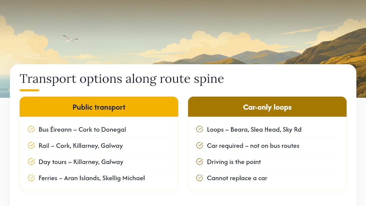
None of this replaces a car for the peninsula loops, Beara, Dingle’s Slea Head, Connemara’s Sky Road, where the driving genuinely is the point. Think of public transport as a way to rest your legs and your concentration for a day mid-trip, not as an alternative to the itinerary itself.
How weather shapes the drive and the sightseeing
Atlantic weather on this coast changes by the hour, not the day, and that has a direct effect on what you’ll actually see. Cliff viewpoints like Moher and Slieve League can vanish into cloud within twenty minutes, and the exposed sections of the Ring of Beara and Sky Road get genuinely difficult in strong crosswinds.
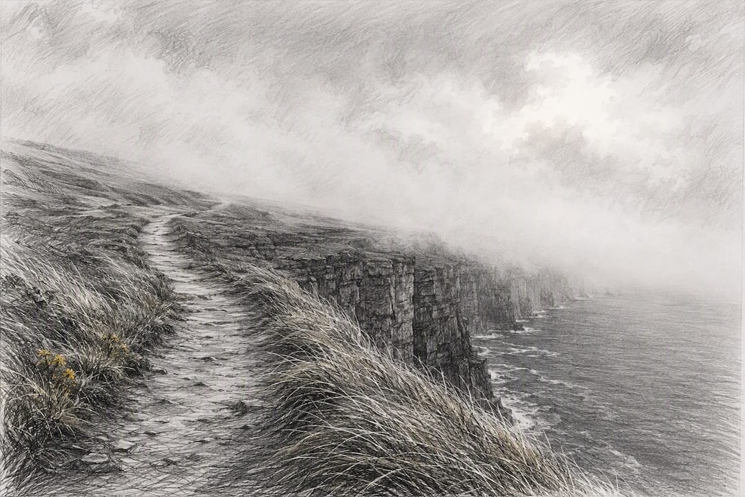
Rain is frequent even outside winter, so treat any single day’s forecast as provisional and build flexibility into which viewpoint you prioritise first. A common local trick: if two cliff walks are on the itinerary and only one has clear skies that morning, do that one first and hope the other clears by afternoon.
Wind matters more than rain for driving comfort on this route. Coastal gusts on exposed headlands can push a car noticeably on the road, which is one more reason the 40 to 60 km/h pace mentioned earlier isn’t just about narrow bends.
Parking at the busiest Wild Atlantic Way stops
The Cliffs of Moher and the main Ring of Kerry viewpoints have paid car parks that fill by mid-morning in summer, so arriving before 10am or after 4pm makes a real difference to both parking and crowds. Some of the smaller Discovery Points have only a handful of roadside spaces, and a full car park there usually just means driving on to the next stop rather than waiting.
Larger vehicles, camper vans especially, face genuine restrictions on some of the narrower loops, including sections of Slea Head Drive and parts of the Ring of Beara, where passing places aren’t sized for anything wider than a standard car. Check vehicle size against the road before committing a camper van to a peninsula loop rather than finding out halfway round. Dingle and Killarney both have dedicated coach and camper parking outside the town centre, which is worth using instead of trying to find street parking in season.
Family-friendly and accessible versions of the route
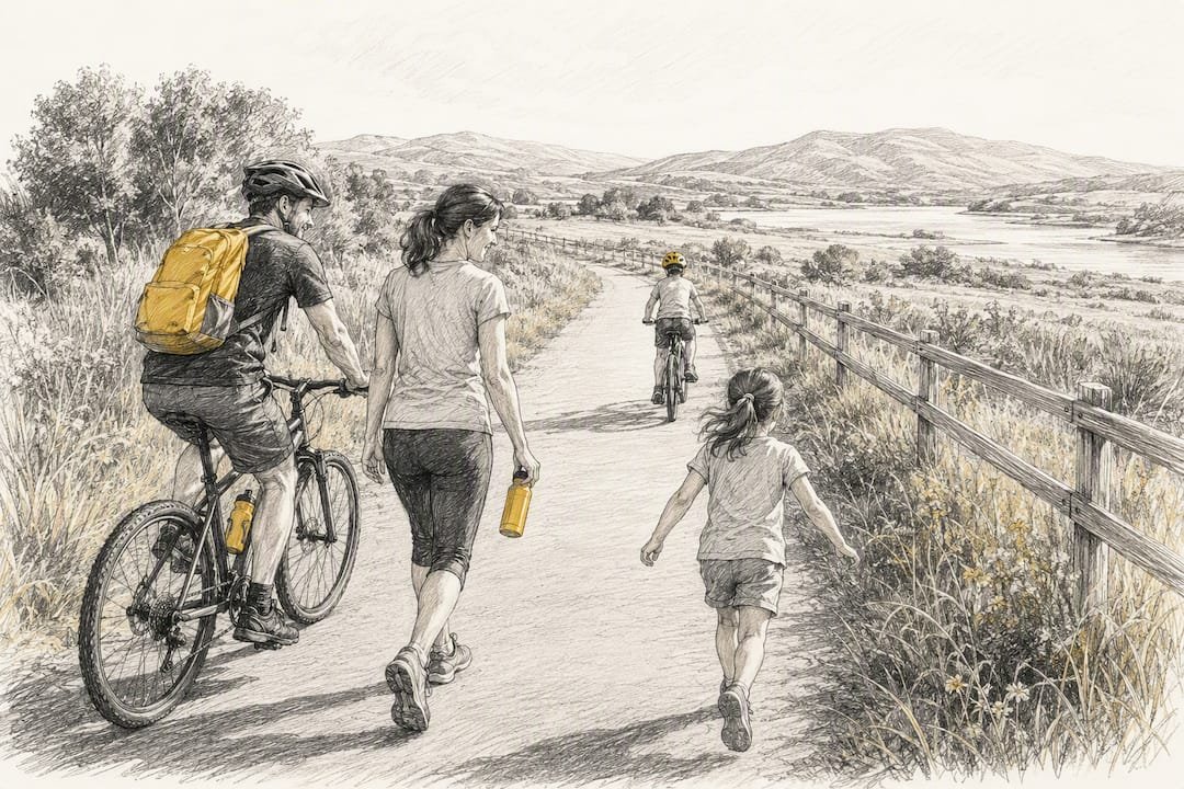
Families travelling with young children generally do better on the 10 day template, since it keeps daily driving under 3 hours and builds in enough slack for tantrums, feeding stops and the inevitable extra half hour at every beach. Inch Beach in Kerry and the Great Western Greenway in Mayo, a flat, traffic-free trail, both work well for children who need to run around rather than sit in a car seat.
For travellers with mobility needs, the Cliffs of Moher visitor centre and main pathways are wheelchair accessible, as are several of the larger Discovery Points with paved viewing areas. Many of the smaller, wilder stops, cliff edge paths on Slieve League or the beehive huts on Slea Head, involve uneven ground and steps that aren’t realistically accessible. Building a mix of the two types of stop into any day, rather than stacking several inaccessible ones in a row, keeps the trip enjoyable for the whole group.
BTOURS’ perspective: when a self-planned trip needs expert help
Self-planning the Wild Atlantic Way works well for a straightforward 7 day loop with no ferries and no islands. The moment your itinerary involves the Aran Islands, Skellig Michael, or a family group with different mobility needs on the same trip, the logistics multiply fast, and that’s where a bespoke planner earns its fee.
BTOURS specialises in custom self-drive itineraries across Ireland, England, Scotland, Wales and Greece, and is a member of the Adventure Travel Trade Association, which sets standards for the sector. What that means practically: someone has already worked out which ferry timetable fits your dates, which B&B has a room for a family of five in August, and which detour is worth the extra hour and which isn’t.
If your trip involves multiple islands, a mixed-ability group, or a fortnight where one missed ferry could unravel three days of bookings, a bespoke itinerary removes the risk rather than leaving you to discover it on the road.
— Theo
Book a bespoke Wild Atlantic Way itinerary instead of building your own
If reading two detailed day-by-day plans has you thinking “I’d rather someone else nailed the ferry timings,” that’s exactly the gap BTOURS fills. Where a self-planned trip means you’re personally responsible for every booking, every backup plan and every “what if the Skellig boat gets cancelled” scenario, BTOURS builds the whole route around your dates, your group and your interests, then hands you a plan with the accommodation and logistics already sorted.

That includes custom routing around whichever regions matter most to you, handpicked accommodation booked in advance rather than left to chance in peak season, and support if something changes mid-trip, a cancelled ferry, a change of plan, a closed road. It makes the most sense for exactly the trips this article flagged as complex: multi-island routes, family groups with different needs, or any itinerary longer than 10 days where one missed booking has knock-on effects.
Start by looking at what to check before booking a self-drive package to see how a bespoke Wild Atlantic Way itinerary comes together, then get in touch with BTOURS to talk through your dates and the regions you want most.
Useful resources for planning your trip
Bookmark the official Wild Atlantic Way route page for the interactive map and downloadable PDF, and check individual attraction websites directly for current opening times before travelling, since hours change seasonally.
Sources
- Wild Atlantic Way route
- Wild Atlantic Way map: route planner, stages & itinerary
- Know before you go: Driving the Wild Atlantic Way
- The Wild Atlantic Way: A MICHELIN Guide road trip
- How to plan a Wild Atlantic Way trip